Membajak Sawah Tradisional Dengan Kerbau di Cisewu Caringin Garut

Membajak Sawah Tradisional Dengan Kerbau di Cisewu Caringin Garut

Spesifikasi Garmin Monterra

GPS Mapping Powerhouse with Android™ OS

  • 4" dual orientation, sunlight-readable, durable mineral glass display with multi-touch interface
  • Get Android apps on Google Play™
  • 8 megapixel autofocus camera and 1080p HD video with automatic geotagging, LED flash/torch
  • High-sensitivity GPS/GLONASS receiver for better positioning
  • 3D MapMerge™ for multiple maps in 3-D
Monterra

Monterra is a full-featured Wi-Fi® enabled GPS navigator that combines our powerful mapping with the versatility of Android. Get Android apps for Monterra on Google Play, including PeakFinder, star constellation charts and ballistic calculator. Or access professional apps such as construction estimators and ArcGIS® to extend your office to the field. The rugged and durable Monterra has the power and flexibility to go anywhere.

3D MapMerge

Monterra is the ultimate mapping tool with custom 3-D mapping. Combine 2 maps, for example TOPO and BirdsEye Satellite Imagery, then view both maps in 3-D. You’ll see rich textures, such as hills, valleys, lakes and forests. Zoom in, pan out and rotate the 3-D map using multi-touch.

Quality Photos

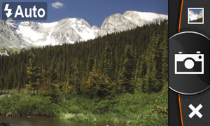
Monterra includes a built-in 8 megapixel autofocus digital camera that takes vivid, geo-tagged photos for easy return navigation plus a 1080p HD video camera with LED flash/torch. You can download photos and video easily to your computer or for sharing through Garmin Adventures. Monterra has plenty of internal memory plus a microSD™ card slot for up to 64 additional GB of memory.

Powerful Battery, Beautiful Display

Monterra has a state-of-the-art dual battery system. You can use the rechargeable lithium-ion pack (included) or traditional AA batteries — the lithium-ion pack charges when device is connected to external power. Its 4" color multi-touch display uses external light and sunlight in combination with the LED backlight to increase screen brightness. Plus, you conserve power by not having to turn on the backlight.

Get Your Bearings

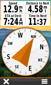
Monterra has a built-in 3-axis electronic compass with accelerometer and gyro, which shows where you're heading even when you’re standing still (or not holding it level). Once calibrated, its barometric altimeter tracks changes in pressure to pinpoint your precise altitude, and you even can use it to plot barometric pressure over time, which can help you keep an eye on changing weather conditions.
A built-in UV sensor lets you know your exposure level to sunlight so you can avoid sun damage, especially at higher elevations (5 percent increase in intensity every 1,000 ft of altitude) and on bright or reflective surfaces (snow, water, etc). And with its high-sensitivity, WAAS- and GLONASS-enabled GPS receiver, Monterra locates your position with more precision and maintains its GPS location even in heavy cover and deep canyons.

Share Wirelessly

With Wi-Fi, Bluetooth® and NFC, Monterra lets you share your data, maps, waypoints, tracks, routes and geocaches up to 50 times faster with other wireless compatible devices. Plus, you can share photos and data from field work through BaseCamp™ or by downloading directly to your computer.

Load Maps and Millions of Geocaches

Add BirdsEye Satellite Imagery (subscription required) and hit the trail. Add Trailhead Series TOPO maps and explore famous treks like the Appalachian Trail and the Pacific Crest Trail. Or, load up your GIS-based maps and go to work.
Monterra can hold millions of geocaches. Download every cache on OpenCaching.com. Load caches from GSAK. Or get your favorite Android app on Google Play. All your paperless geocaching features will be there for every cache. Read full descriptions, hints and logs. View cache photos. Filter caches by size, terrain, difficulty and type. Connect to chirp™-enabled caches.

Radio

Never miss vital information (or entertainment) with Monterra’s built-in FM radio and NOAA weather radio with SAME alerts. Get watches and warnings related to your location. Listen with headphones or share with the whole group through the built-in speaker.

Plan Your Next Trip

Take charge of your next adventure with BaseCamp, software that lets you view and organize maps, waypoints, routes and tracks. Create Garmin Adventures to share with friends, family or fellow explorers. BaseCamp displays topographic map data in 2-D or 3-D on your computer screen, including contour lines and elevation profiles. It also can transfer an unlimited amount of satellite images to your device when paired with a BirdsEye Satellite Imagery subscription.

Mount It Anywhere

With an array of compatible mounts, Monterra is designed for use on ATVs, in boats, as a handheld or in your car. Use the automobile mount for spoken, turn-by-turn driving directions, or the rugged mount for your motorcycle or ATV.
Android and Google Play are trademarks of Google Inc.
WAAS enabled Geocaching ready Waterproof ANT
 

Physical & Performance:

Unit dimensions, WxHxD2.9" x 5.9" x 1.4" (7.48 x 14.96 x 3.63 cm)
Display size, WxH2"W x 3.5"H (5.06 x 8.93 cm); 4" diag (10.2 cm)
Display resolution, WxH272 x 480 pixels
Display typebright, transflective 65k color TFT, dual-orientation touchscreen; sunlight readable
Weight11.7 oz (331 g) with included lithium-ion battery pack; 13.2 oz (375 g) with 3 AA batteries (not included)
Batteryrechargeable lithium-ion (included) or 3 AA batteries (not included); NiMH or Lithium recommended
Battery lifeup to 16 hours (lithium-ion); up to 22 hours (AA batteries)
WaterproofYes (IPX7)
FloatsNo
High-sensitivity receiverYes
InterfaceHigh-speed USB

Maps & Memory:

BasemapYes
Preloaded mapsyes (topographic), some models
Ability to add mapsYes
Built-in memory6 GB (With Worldwide Basemap); 3 GB (With TOPO U.S. 100K Maps)
Accepts data cardsmicroSD™ card (not included)
Waypoints/favorites/locations4000
Routes200
Track log10,000 points, 200 saved tracks

Features & Benefits:

Automatic routing (turn by turn routing on roads)Yes (with optional mapping for detailed roads)
Electronic compassYes (tilt-compensated 3-axis)
TouchscreenYes
Barometric altimeterYes
Camerayes (8 megapixel with autofocus and 1080p/30fps video; LED flash; automatic geo-tagging)
Geocaching-friendlyYes (Paperless)
Custom maps compatibleYes
Photo navigation (navigate to geotagged photos)Yes
Hunt/fish calendarNo
Sun and moon informationNo
Tide tablesNo
Area calculationYes
Custom POIs (ability to add additional points of interest)Yes
Unit-to-unit transfer (shares data wirelessly with similar units)Yes
Picture viewerYes
Garmin Connect™ compatible (online community where you analyze, categorize and share data)Yes
Additional
  • Bluetooth® wireless technology: yes
  • Wi-Fi connectivity: yes
  • ANT+™ connectivity: yes
  • GNSS support: yes (GPS + GLONASS)
  • Near Field Communication (NFC): yes
  • Microphone: yes (internal for audio capture)
  • Multimedia (audio/video) support: yes (MP3 player, video player, etc.)
  • UV sensor: yes
  • Android with Google Play for complete customization

Fitur dan spesifikasi GPSMAP® 585

FITUR

GPSMAP 585 adalah full-fungsi grafik plotter yang dilengkapi dengan layar warna 5 "WQVGA ultra-terang bersama dengan fitur peningkatan kecepatan tinggi menggambar peta dan panning. Sudah siap untuk pergi dengan antarmuka yang mudah digunakan dan basemap di seluruh dunia built-in. 585 unik Garmin grafik komplotan yang tidak hanya membekali dengan bahasa Inggris tetapi juga dengan bahasa-bahasa Asia termasuk Cina Sederhana dan Bahasa Indonesia. GPSMAP 585 dirancang khusus untuk nelayan profesional dan dilengkapi dengan keunggulan Garmin terkenal GPS168 / 178C komplotan grafik. Terlebih lagi, kini Anda dapat ikan dengan plotter grafik berkualitas tinggi dengan biaya lebih terjangkau.

Jelajahi Lautan

GPSMAP 585 datang standar dengan sensitivitas tinggi modul GPS built-in untuk pelacakan satelit unggul dan akuisisi kali lebih cepat. Dan dengan slot kartu SD, mudah untuk menambahkan peta tambahan tanpa terhubung ke komputer.

Tambahkan Sonar
Mana yang berlaku, versi sounder, GPSMAP 585, dilengkapi dengan transduser opsional yang dengan jelas dapat menggambarkan kontur kedalaman, target ikan dan struktur. Apakah Anda sedang memancing di air tawar atau lepas pantai, Anda selalu dapat menemukan tepat Garmin transduser dari berbagai jenis sesuai dengan kebutuhan anda. GPSMAP 585 juga NMEA 0183 kompatibel untuk konektivitas dengan sensor, instrumen dan penawaran kelautan masa depan.

Physical & Performance:

Unit dimensions, WxHxD: 5.9" x 6.4" x 2.9" (15.0 x 16.3 x 7.4 cm)
Display size, WxH: 5”, 120.7x75.8mm
Display resolution, WxH: 480x272 pixels
Display type: WQVGA
Weight: 390g
Waterproof: yes (IPX7)

Maps & Memory:

Basemap: yes
Preloaded maps: no
Ability to add maps: yes
Accepts data cards: SD card slot
Waypoints/favorites/locations: 6000
Routes: 150 tracks/250 points

Features:

CANet® compatible: no
Supports AIS (tracks target ships' position): yes
Supports DSC (displays position data from DSC capable VHF radio): yes
Audible alarms: yes
Tide tables: yes
Sun and moon information: yes
3-D map view: no
Dual-frequency sonar capable: yes
Dual-beam sonar capable : no
Split-screen zoom: yes
Split-screen sonar/gps: yes
Ultrascroll™ (displays fish targets at higher boat speeds): yes
See-thru® technology (exposes fish hidden in cover): yes
Fish Symbol ID (helps identify fish targets): yes
AutoGain Technology (minimizes clutter, maximizes targets): yes
Whiteline (indicates hard or soft bottom): yes
Adjustable depth line (measures depth of underwater objects): yes
A-scope (real time display of fish passing through transducer beam): yes
Bottom lock (shows return from the bottom up): yes
Water temperature log and graph: yes
Water temperature sensor included: yes (need to equipt with correct tranducer)

Sonar:

Frequency: 50/200 kHz
Transmit power: 500W(RMS), 4,000W(peak to peak)
Voltage range: 10-36 VDC
Maximum depth*: 1,500ft
Cone angle: 20 degrees
*Depth capacity is dependent on water salinity, bottom type, and other water conditions.

Spesifikasi iBlue 747Pro

This BT GPS logger features an all-in-one, cost-effective portable GPS logging solution with buzzer. It allows you to log your route by setting the interval of time/ distance/ speed. Point of interest can also be recorded by push of a button. Through user friendly utility, it shows your track on Google Earth.
Key Features:
• Dual mode : Data record / Navigation
• Push button for POI recording
• Smart log of time, distance and speed
• Log up to 250,000 waypoints
• Embedded sensor for smart operation
• Long operation time
• Smart auto on/off
• Audio alarm
• Rechargeable battery
• Bluetooth V1.2 compliant
• Phototagger software
• High receiving sensitivity with AGPS capability

Application:
• Record your travels
• Manage trip expense
• Manage field team
• Point of interest recording
• Geo-photo tagging

Spesifikasi iBlue 747Pro

CategoryParameterDescription
GeneralGPS ChipMTK
FrequencyL1,1575.42 MHZ
C/A Code1.023MHz chip rate
Channels66 CH for tracking
AntennaBuilt-in patch antenna with LNA
DatumWGS-84
AcquisitionCold Start35 sec, average
Warm Start34 sec, average
Hot Start1.5 sec, average
AGPS<15sec
PowerBatteryLi-Ion
Charging time3hrs (Typical)
Operation Time25hrs
Power ChargeMini USB
EnvironmentalOperating-10°C to +60°C
Storage-20°C to +60°C
Charging-10°C to +45°C
Relative Humidity20% to 80% non-condensing
Accuracy
(none DGPS)
PositionWithout aid: 3.0m 2D-RMS
DGPS: 2.5m, 2D-RMS
VelocityWithout aid: 0.1m/s
DGPS: 0.05m/s
Sensitivity-165dBm (tracking)
DynamicAltitude<18,000m
Velocity<515m/sec
Acceleration4G
InterfaceBluetoothversion 1.2 compliant
Output PowerClass2 (10 meter in free space)
Frequency2.4 to 2.4835GHz
Protocol NMEA-0183 (V3.01) - GGA, GSA, GSV, RMC (default)
Data bit: 8, stop bit:1 (Default)
PhysicalDimension47W x 72L x 20H mm
Weight65g
Data Log Up to 250,000 way points.
Log GPS data by time interval / distance / speed limit.
Log GPS data by push button.
OthersAudioBuzzer
CertificationCE / FCC / MIC
SensorVibration sensor
SwitchPower / Log / Navigation
ButtonPoint of Interest
*Bluetooth is a trademark owned by Bluetooth SIG, Inc.
*Specifications subject to change without prior notice.
*Copyright© 2010 Transystem Inc. All Rights Reserved.
*Citation MTK original chipset spec
 

Spesifikasi GlobalSat ND-100

The GlobalSat ND-100 is a compact and portable device, which allows you to carry a GPS receiver for use on your laptop whenever you travel. The GlobalSat ND-100 requires no battery or cables, only your favorite NMEA compliant navigation software is all that’s needed to turn a laptop into a powerful navigation system.

Features:

  • USB 2.0 interface
  • Build-in high sensitivity GPS chip
  • High GPS sensitivity: -161 dBm
  • Support SBAS (WAAS and EGNOS)
  • Support Microsoft® Windows 2000/XP/Server 2003/VistaTM
  • Support Macintosh OS 8/9/10.X, RedHat 7.3 / 8.0 / 9.0

Specifications:
GPS Characteristics
GPS Chipset
High sensitivity single chip solution
Frequency L1, 1575.42 MHz
C/A Code C/A Code
Channels 48 channel all-in-view tracking
Sensitivity Tracking:-161dBm
GPS Antenna Type Built-in ceramic patch antenna (18 x 18 x 4mm)

Acquisition Rate
Hot start 1.5 sec., average
Warm start 32 sec., average
Cold start 34 sec., average
Reacquisition <1 sec. average

Protocol
GPS Protocol NMEA 0183v3 GGA(1sec), GSA(1sec), GSV(5sec),RMC(1sec), GLL,VTG is optional
GPS Transfer Rate 38400
USB Protocol USB 2.0

Operating Systems
Windows 98 / 2000 / XP / Vista
Mac OSX 8&9 / 10.x
Linux RedHat 7.3 / 8.0 / 9.0

Temperature
Operating
-4°~140°F (-20°~60°C)
Storage -22°~ 158°F (-30°~70°C)
Humidity Up to 95% non-condensing

Power
Voltage
DC 5.0V, USB bus power
Current < 55 mA

Physical Characteristics
Dimension 2.6”L x 0.9”W x 0.4”H (65.5L x 23W x 11H mm)
Unit Weight 0.04 lbs (20g)

Certifications
FCC USA (Covers requirements for CANADA ICES-003)
CE Europe

Spesifikasi Oregon® 650

More Features, More Satellite Power Behind a Tough, Bright Touchscreen

  • 3" sunlight-readable touchscreen display with dual orientation
  • 8 MP autofocus camera with LED flash/torch
  • Worldwide basemap with shaded relief
  • 3-axis compass with accelerometer and barometric altimeter sensors
  • Dual battery system — 2 AA batteries or included rechargeable internal NiMH pack

Oregon® 650

With high-sensitivity GPS and GLONASS satellite tracking, worldwide basemap with shaded relief and customizable buttons for 1-touch image capture and waypoint marking, Oregon 650 opens a new world of GPS mapping and positioning.

Quality Photos

Quality Photos

Take quality photos with Oregon 650's built-in 8 MP autofocus digital camera. Each photo is geotagged, allowing you to navigate back to that exact spot. Share the photos with all your friends through Garmin Adventures. For more storage, insert a microSD™ card; you can even view pictures from other devices on microSD card with Oregon's picture viewer.

Touch and Go

Oregon 650 has reflective display technology for the most brilliant, sunlight readable touchscreen we’ve ever made. It's as vivid in full bright sunlight as it is in shade. The screen has been strengthened for impact resistance but still accommodates gloved operation. And with dual-orientation, multi-touch screen, you won’t just look at maps, you’ll interact with them when you zoom in, pan out and rotate the display.

Double Your Power

Oregon 650 features our state-of-the-art dual battery system. You’ll have the option of using the internally rechargeable NiMH pack (included) or traditional AA batteries — NiMH pack charges when the device is connected to external power.

Get Your Bearings

Get Your Bearings

Oregon 650 has a built-in 3-axis electronic compass with accelerometer tilt compensation to show where you're heading even when standing still, or not holding it level. Its barometric altimeter tracks changes in pressure to pinpoint your precise altitude. You can even use it to plot barometric pressure over time to keep an eye on changing weather conditions.
With its high-sensitivity, WAAS- and GLONASS-enabled GPS receiver and HotFix® satellite prediction, Oregon 650 locates your position quickly and precisely, and maintains its GPS location even in heavy cover and deep canyons.

Share Wirelessly

With Oregon 650 you can share your waypoints, tracks, routes and geocaches up to 50 times faster with other wireless compatible Garmin handheld devices. Plus, you can share large files too like photos, Garmin Adventures and Custom Maps. Just touch “send” to transfer your information.

Add Maps

Adding more maps to Oregon is easy. Load TOPO U.S. 24K maps and hit the trail; add Trailhead Series TOPO maps and explore famous treks like the Appalachian Trail and the Pacific Crest Trail; plug in BlueChart® g2 preloaded cards for a great day on the water; or load City Navigator® map data for turn-by-turn routing on roads. Add satellite images to your maps with BirdsEye Satellite Imagery (subscription required).

Load All the Geocaches

No more picking, choosing and planning, just download them all. The Oregon 650 can hold up to 4 million. Download every cache on OpenCaching.com. Load caches using your favorite program or website that supports GGZ files. All your paperless geocaching features will be there for every cache. Read full descriptions, hints and logs. View cache photos. Filter caches by size, terrain, difficulty and type. Connect to chirp-enabled caches. Record your logs in the field. Do it all.

Plan Your Next Trip

Take charge of your next adventure with BaseCamp™, software that lets you view and organize maps, waypoints, routes and tracks. This free trip-planning software even allows you to create Garmin Adventures that you can share with friends, family or fellow explorers. BaseCamp displays topographic map data in 2-D or 3-D on your computer screen, including contour lines and elevation profiles. It also can transfer an unlimited amount of satellite images to your device when paired with a BirdsEye Satellite Imagery subscription.


Physical & Performance:

Unit dimensions, WxHxD2.4" x 4.5" x 1.3" (6.1 x 11.4 x 3.3 cm)
Display size, WxH1.5"W x 2.5"H (3.8 x 6.3 cm); 3" diag (7.6 cm)
Display resolution, WxH240 x 400 pixels
Display typetransflective color TFT touchscreen
Weight7.4 oz (209.8 g) with batteries
Batteryrechargeable NiMH pack (included) or 2 AA batteries (not included); NiMH or Lithium recommended
Battery life16 hours
WaterproofYes (IPX7)
FloatsNo
High-sensitivity receiverYes
Interfacehigh-speed USB and NMEA 0183 compatible

Maps & Memory:

BasemapYes
Preloaded mapsno
Ability to add mapsYes
Built-in memory3.5 GB
Accepts data cardsmicroSD™ card (not included)
Waypoints/favorites/locations4000
Routes200
Track log10,000 points, 200 saved tracks

Features & Benefits:

Automatic routing (turn by turn routing on roads)Yes (with optional mapping for detailed roads)
Electronic compassYes (tilt-compensated 3-axis)
TouchscreenYes
Barometric altimeterYes
Camerayes (8 megapixel with autofocus; digital zoom)
Geocaching-friendlyYes (Paperless)
Custom maps compatibleYes
Photo navigation (navigate to geotagged photos)Yes
Hunt/fish calendarYes
Sun and moon informationYes
Tide tablesYes (with optional Bluechart)
Area calculationYes
Custom POIs (ability to add additional points of interest)Yes
Unit-to-unit transfer (shares data wirelessly with similar units)Yes (plus images and custom maps)
Picture viewerYes
Garmin Connect™ compatible (online community where you analyze, categorize and share data)Yes